Tenerife, The Canary Islands (Spain)
For Spring Break this year, we missed out on the standard trip down to 30A and settled for some islands off the coast of northern Africa. In my (American-brained, geography-challenged) world, that meant that we were going to be somewhere close to the equator - nice and warm! As it turns out, the
Canary Islands are on about the same latitudinal line as Orlando! We have lots of experience with Destin-area weather during this week, and that's pretty similar to what we experienced for most of our week - mid- to upper-60's, lots of sun and lots of wind.
We stayed on the island of
Tenerife, which is about twice the size of Metro Louisville. We spent most of the trip lying at the pool relaxing and enjoying the sun. With the exceptions of a trip to the island's dominant feature
El Teide (the world's third-largest volcano - more about that shortly) and a day-trip to a water park, we hardly left the resort - the Gran Meliá Palacio de Isora. A great trip overall!
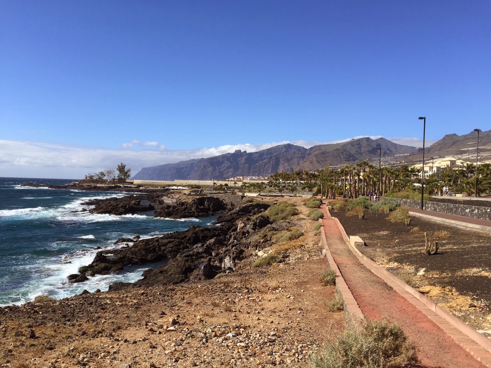 |
| The coastline just outside of our resort - lots of big rocks for the waves to break on, and some huge cliffs in the background. |
 |
| One of the many gorgeous sunsets we watched. |
 |
| The Lewis girls! |
 |
| These cliffs a little to the north of our resort are called Acantilados de Los Gigantes - in some areas they rise over 1/2-mile straight up out of the ocean. They are accessible if you have the time and determination - we didn't. |
 |
| A view of the small resort town names after the cliffs (Los Gigantes), located a couple of miles north along the coast from our resort. |
 |
In case there weren't enough flower pictures in the previous post...
I found the sun hitting this Bird of Paradise perfectly one afternoon! |
 |
| I thought the progression of the birds opening was interesting - I noticed one that was in the initial stages early in the week and took a picture for a few days in a row (the two pictures above). It didn't get all the way open before we left, so the lower picture above is from a different plant. These are my favorites, although I like the more colorful ones better! |
 |
| The older two girls got some very rudimentary and quick (and free) scuba diving lessons at the resort. Only 5 minutes or so in total, but they got an idea of what it's like - and I think they were both excited to do it for real! Lilli is in this shot. |
 |
| Lucy! |
I got out one day for a bike ride to see what else was around. Lots of banana farms, rocky beaches, and sketchy trails for most of the trip south until I finally found a reasonably fun trail. About 2 minutes into that, my 6-Euro rental bike's bald back tire blew out - about 8 miles from the resort. It was a long walk back, but I swapped bikes out and went north (towards Los Gigantes) for a ways. The trail ran out rather quickly so much of the biking was on the road, but at least I got to climb some hills - always a welcome change from Dutch biking!
 |
Black beaches were common. The one at our resort was black sand at least - this one appeared to be rocky.
There is someone fishing out on the crag in the center. Would have been fun watching him walk out there! |
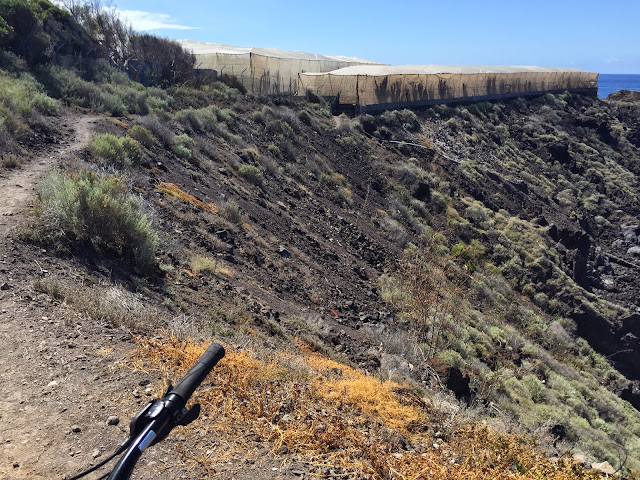 |
| Some of the sketchy trail - some spots were downright scary (I walked them). The trails were mostly continuous along the coast to the south, cut in just below the banana farm walls. |
 |
| Here the trail branched out onto a small piece of rock that juts out into the ocean. Looking back towards the island you get an idea of what the banana farms look like... Concrete walls, often with cloth above (wind protection??). |
 |
| This shot is from a large wall protecting the harbor/ marina in Playa de San Juan |
 |
| This one is looking out at the wall from the hill above. |
The volcano(es)
I couldn't help but think that had I made this trip as a teenager I may have had a completely different education and job as an adult - the volcano was fascinating. It is surrounded by a national park that was a 50 km (~30 mile) drive, from sea level at the resort to 2,300 m (7,500 ft) up at the base of the volcano. During the drive, you pass through a (semi-?) permanent cloud layer between 1,500 and 1,800 meters - very cool! Below the clouds, it was obviously very dreary and overcast, but when we passed through, it was amazingly clear!
 |
| This was taken on the way back down, but gives a good idea of what the layer looks like on the next island over. |
 |
| El Mar de Nubes (Sea of Clouds) - as seen from above. |
Clouds were not what piqued my interest so strongly however - the geology was. Driving into the park was like nothing I've ever seen. In the lower areas (below the clouds), obvious areas of old lava flows were covered sporadically with pine trees and sparse vegetation; there is plenty of oxygen and warmth to support it.
 |
| Just at the top of the cloud layer (photo credit to Holli) |
The plants and trees began to thin out above the clouds as the air grew thinner and the temperatures dropped (it was near 20C (68F) at the resort but dropped to near 0C (32F) by the time we reached our highest point).
At some point we drove on a road that went through a black lava field - the road was rough, as though it was difficult to maintain for some reason. But the surrounding area was almost scary, with a post-apocalyptic feel. Large, porous black rock was the only thing around - no signs of life whatsoever other than the road.
 |
| Unfortunately we didn't get pictures from the ground, but this grab from Google Maps shows both the area I describe and the reason for its appearance - this is from a lateral eruption from Pico Viejo (another picture of that volcano below) in 1798. |
 |
| Pico Viejo is one of the two volcanoes now on the island. This one's peak may have disappeared during the 1798 eruption, leaving a huge crater in its place. The lateral eruption in the previous picture came from the back side. |
The island began to form two or three million years ago from three separate (sub-sea?) volcanoes. These eventually began to grow together before they became inactive. Another volcano formed in the middle of these (Las Cañadas) and grew to an estimated 4,500 m (14,800 ft) in height before the summit collapsed (for the first time) around 200,000 years ago. This collapse created the Las Cañadas caldera, which I would describe as crater-like. The current volcanos, Teide (also called Las Cañadas IV as it collapsed two more times in the last 200 millennia) and Pico Viejo, are formed within this caldera.
 |
| The Las Cañadas caldera from Google Maps - the caldera walls are obvious to the south and east. The previous picture of Pico Viejo (the crater due west from dead-center above) was taken from the star on Teide. |
The drive into the park ended at a parking lot where you could ride a gondola up to near the peak of Teide. The ride wasn't cheap (26 Euro for adults, 13 for kids) and there was a line that took around an hour to get through, but with zero planning on our part and a 6-year old in tow, we were in no position to hike up (which IS an option and I would like to do should we ever return).
From the top of the gondola, hiking trails go around the "mountain" in each direction, and another trail leads up to the summit. The summit hike requires advance registration with the national park service, however, so we decided to walk west for a little way. The trail was made from rocks laid more-or-less flat, but there were lots of holes/ uneven spots that could easily twist an ankle. And some of the spots had nasty potential falls to the downhill side, so it was a little nerve-racking with the three energetic girls (who had been standing in a line for an hour). We made it through with almost no injuries, and got to see some incredible views.
 |
| The darker area in the center is an old lava flow that abuts the gondola entrance & parking lot. It can be seen in the dead center of the Google Map above, under the "Parque Nacional del Teide" label. The flow can be easily traced up to find the top of the gondola. Note the sparse vegetation and the caldera walls in the background (this was taken from the gondola). |
|
 |
| Despite the lack of vegetation, Lucy claimed to have spotted a lizard among the rocks... |
 |
| I don't think they really want people going off of the trail, but we've never been very good as a family about following rules. |
 |
| Eliza with her souvenir (a rock), which she had to give to the gondola operator before we got on for the ride down. Turns out the American national park saying "Take nothing but memories, leave nothing but footprints" applies in Spain as well. |


No comments:
Post a Comment