For Fall break this year (when did schools start taking a week off in the fall? I don't remember this when I was a kid!), we decided that we wanted to relax and get some sun instead of tramping through the streets of an ancient city looking at churches that pre-date the discovery of the New World.
We decided on the Greek island of Santorini (a.k.a. Thera/ Thira/
Θήρα), which turned out to be a pretty good decision!
 |
This it NOT Santorini (Ha!), but it is a very good shot that
Holli got of the island of Fleves as we were taking off from Athens! |
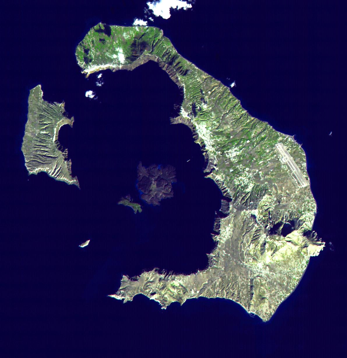
The island as it exists today was formed about 3,600 years ago during the
Minoan eruption, one of the largest volcanic eruptions in recorded history. Imagine a volcano-shaped mountain about 9 miles in diameter at its base. Now imagine that an explosion removed 14
cubic miles of rock out of the mountain, blowing out the western side and opening the crater up to the sea. The remaining land (a caldera) is in the shape of a crescent, open to the west, with steep walls on the inside and generally more gradual slopes to the outside. Volcanic activity continues in the center of the "lagoon", where two small islands rise from the sea by about 3" per year.
 |
NASA gets credit for this photo... But at least it IS Santorini!
And as I am writing this, I saw this article on the IFLScience news feed... Good thing we didn't read it before we went! |
Fewer than 16,000 people live on the island year-round. The economy is now mostly based on tourism, although agriculture still contributes a significant portion (mostly via the wine industry). We saw several cruise ships in the lagoon during our stay, with hundreds of tourists disembarking and making their way up into the town of Fira (many using a gondola, but not the kind discussed in my last entry). While we did not see that many where we stayed, the annual influx of 500,000 tourists has had a significant effect everywhere on the island.
Lucy and I popped into watch an artist/ jeweler brazing some earrings (see below) in his shop after dinner one night, and he was nice enough to talk to us for a little while. He remembered being able to play soccer in the now-crowded "streets" when he was growing up (he is a couple of years younger than me) - the only tourists at that point were the kind that came every year and stayed for weeks at a time. Go back another generation to the late 1950's when nobody was coming - an earthquake destroyed a great deal of the buildings and many inhabitants, having had enough, were leaving for good.
Our experience, however, was great. There were no crowds to speak of, the weather was nice (low to mid-70's all week, only rained one day), our hosts were incredibly friendly, the food was awesome, and the scenery was amazing. The lack of crowds I'm sure was a result of both when we visited (late October) and where we stayed - the town of
Oía.
Oía (pronounced like New Englanders say "here", without the preceding h: EE-ah) is a small town of ~3,500 people located on the top of the northern caldera wall. Multiple "hotels" and a couple of sidewalks/ stairs dug into the wall as it slopes nearly 500 ft down to the sea. The pictures will do a better job of describing it than I can.
 |
| The whitewashed structures at the top are mostly homes and hotels, and you can see the access "road" coming down from the top (left of center). We didn't venture down on this side; the pictures below are from around the corner to the left (west). |
 |
| Lilli got the best picture of the town from the top! |
 |
| Holli got the best picture of a storm, although it never amounted to more than a light rain when it got to us. |
The Hotel
Our hotel - like most - was carved into the hillside, more like a cave than a free-standing building. The inside was very comfortable, but it felt a little strange nonetheless.
 |
| Looking in from the entrance - master bedroom (that we shared with Eliza) through the door, second bedroom on the left, second bathroom on the right (next to E). |
 |
The living area from another step inside, and the entrance to the second bedroom.
Lilli's sock-covered foot to the left. |
 |
| Master bathroom - not as dark as it looks; actually a pretty cool space! |
 |
The patio - not a bad place for breakfast! And an incredible breakfast it was (every day)!
I did not come home lighter than when I left. |
 |
| The girls enjoyed the hot-tub, but it wasn't what I would call hot... Maybe European hot? |
The Boat Trip
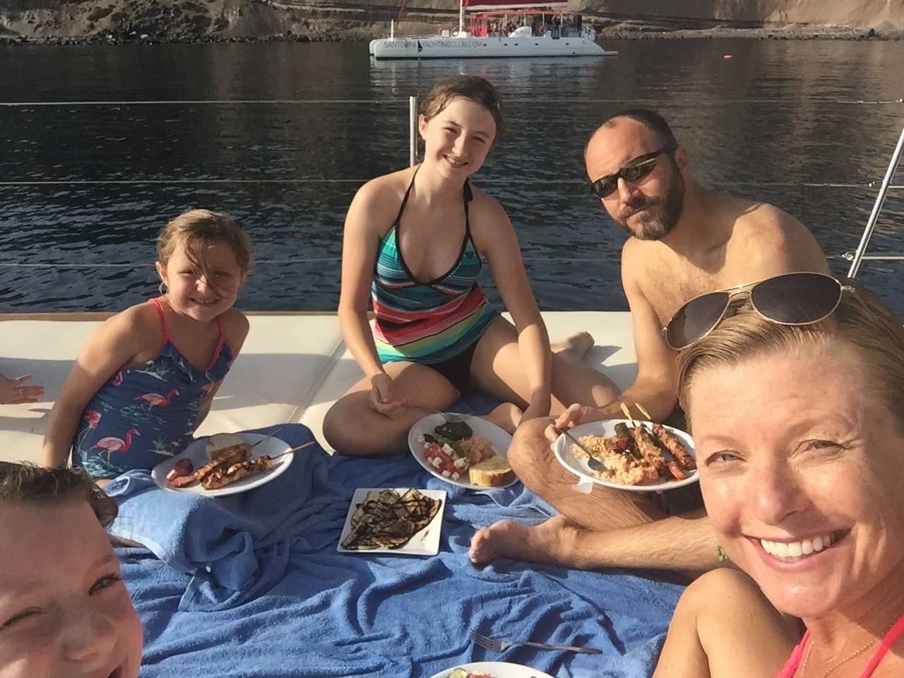
Holli and the girls were pretty excited about the idea of taking a boat trip around the island, and the one that they decided on was terrific. We had a ~30 minute bus ride to the southern tip of the island where we began our 4+hour journey. It was probably the highlight of the week.
 |
The first stop was the red beach, where the sand really is this color.
The boat anchored here and we swam in to check it out. |
 |
| Several canoes disappeared into this hole as we passed by. |
 |
| Dinner was included in the trip - as with every meal we had during the week it was top-notch! |
 |
| This church (Ekklisia Agios Nikolaos) has its own island - we didn't get to check it out any closer than this though. |
 |
| The boat's final destination was this port just to the west of the other picture of Oia (way above). It is much easier to see the walkway down to this side, and we would come back down for dinner later in the week. |
A few gratuitous sunset shots:
The Long Walk
There's not a tremendous amount of stuff to do here, which was part of the reason we picked it! But among the Tripadvisor top-picks was hiking the trail "from
Fira to Oia". That walk is probably a little easier than the one from
Oia to Fira (that we took) since there is a pretty consistent uphill gradient on the latter (Fira sits about 500 ft higher).
Lilli and I made a couple of extra/ unnecessary climbs to some off-the-beaten-path peaks (see the pics below), while there was quite a bit of complaining from the youngest lady. In fairness, it was warm... But come on! Time to stiffen up that spine! You're almost 7 years old!
 |
Not too far from the start of the walk.
Lucy was the only one smart enough to bring a hat, and she knows how to wear it! |
 |
~500 ft above the sea - about the same as Oia. Few complaints so far.
Not NONE by any means, but it was early still... |
 |
| About 1,000 ft up here |
 |
| I kept seeing spent shotgun shells on the ground, then we jumped a huge covey of quail living in the cacti! |
 |
| She's happy now, 'cause she knows what's coming! |
 |
According to her, "her first banana split!" I know better, but she earned it...
About 10 km (over 6 miles) plus a total elevation gain of over 1,200 ft - that's no easy walk for someone her size! |
The City of Atlantis
Santorini (
Akrotiri) is arguably the leading contender for places most likely to have been the lost city of Atlantis. There is a pretty incredible archaeological site on the island's southern (exterior) coast, where I believe you can see Crete on a clear day (although it's nearly 70 miles away).
The site is completely covered from the weather and continues to be unearthed today - there were workers patiently using shovels to fill burlap bags with what I assume was volcanic ash while we walked through. The discoveries are quite well preserved, including large pottery that is completely intact!
 |
In the pictures it looks almost fake or recreated, but these are authentic rooms and buildings
- an entire city really, that was covered with rubble for 2,600 years! |
 |
You can get a better idea of the scale of the place from this angle. I was struck by the gray color dominating everything.
I can't imagine how different and alive it might look after a good rainstorm, but the roof prevents that cleaning. |
 |
A model shows the entire city as it currently exists from about the same position as the picture above.
Well, maybe from about 100 feet higher... I love scale models! |
Other outings
Because the beach was not within easy walking distance, we made a couple of trips out and about in the car to see some sights. We found a couple of different kinds of beach (bigger pebbles vs. black sand, as compared to the red sand beach described above), some great views, a WWII-looking building, and some adult beverages among other things.
 |
| This was the second beach we tried out, after a nice "local" pointed out that the first beach we stopped by might not be appropriate for the girls. ;) The lawn chairs were broken down, but the drinks were just fine and the price was right! |
 |
This is from a day or two later... I got a good start on my World War I book,
which has a perfect amount of detail for an initial venture into the subject! |
 |
I put my book down long enough to take this... That is a swan just to the right of center, followed by two more off to the left.
I did not know that they were fond of salt water, but they seemed to be doing very well! |
 |
This military-looking building sits at Santorini's highest point - about 1,700 ft. The sign is in Greek, but has what appear to be radiation symbols on it - could be due to the cellular tower...
You may also notice that there is a church attached to the building to the right - we were able to do a quick walk-through. |
 |
| The view from the church's terrace |
 |
| Not a bad view from the hotel either! |
 |
| I make a concerted effort to try out the local brews wherever we go. I was surprised and happy to find several good Greek beers (Alfa, Hellenic, Mythos, Volkan), plus three nice offerings from the local Santorini Brewing Co. called Yellow Donkey, Red Donkey, and Crazy Donkey. We bought souvenirs, cause that's how we roll. |
 |
| Santorini is much better-known for its wine than for its beer. We ordered the "6 wine" sampler after seeing that these weren't sample-sized glasses (they also offer 12- and 18-wine samples!). The girls enjoyed some hot chocolate while we made our way through the selections - they are all locally produced and were very tasty. We got "souvenirs" here as well. |
The rain finally came on the day before we left. Holli took the girls out to see some shops and I took a walk around Oia and the cliffs. The area is a study of contrasts: beautiful buildings sitting right next to broken-down wrecks; structures built literally on top of each other within eyesight of vast open spaces that are seemingly unused; litter dominating some public areas despite millions of Euros in tourism and tax revenue. It is difficult for this American to understand - finding the right balance between sustaining the population but not losing the proud Greek culture and heritage.
 |
| Case in point. |
 |
| The day wasn't completely melancholy... I did check out the remains of a huge house (castle?) on the point looking down on Amoudi Bay. Nice place to live if the ground wasn't falling away below it, which I assume is why it is still a ruin! |
 |
Last panoramic, I promise. I try to avoid putting them into the blogs as they don't really come out that great,
but this place really inspires them! |
 |
The same "house" from below. It extends down quite a way.
Another large ruin sits in the center of the picture, adjacent to a new house in white. |
 |
| They did take time away from shopping to take this nice picture! |
 |
The sun finally came out and we walked down to Amoudi Bay to have dinner.
The mountain in the background is the same one as above, just a little lower and to the right. |
 |
| They were nice enough to catch this for us to have for dinner! |
 |
| Eliza found some new friends. What they lack in size they make up for in numbers. |
 |
| One last sunset picture from our dinner table. |
I would put this up there with one of the best vacations spots that we've had in Europe. If I had been able to rent a decent bicycle I think it would almost rival Nice, but there were surprisingly few options. ATV rental shops were everywhere - as were the ATVs themselves. That is probably a nightmare during tourist season, but it wasn't a problem in late October.
Until next time---
 |
| This has no real place here, but I've been meaning to post a shot of a Czech Budweiser for a while, and I finally tried one out while in Greece. Better than the American version.... But that's a pretty low bar. |


